

As an Amazon Associate I earn from qualifying purchases.
Clement's Bridge
Clements Bridge Rd.
Map / Directions to Clement's Bridge
Map / Directions to all Deptford Revolutionary War Sites
British forces occupied Philadelphia from September 26, 1777 until June 18, 1778. It was during this time that the British sent Hessian troops to attack Fort Mercer, an American fort on the Delaware River in what is now National Park. (Hessians were German mercenary soldiers hired by the British to fight in the Revolutionary War.)
On October 21, 1777, Hessian troops under the command of Colonel von Donop crossed the Delaware River into New Jersey, landing in Cooper's Ferry (now Camden). They marched to Haddonfield, where they camped for the night.
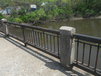
The following morning, they marched southwest towards Fort Mercer. In order to reach Fort Mercer, the Hessians needed to get across the Big Timber Creek at some point. They marched to the location of a bridge in what is now Brooklawn. However, they found that the bridge here had been dismantled by American forces. This caused them to march an additional eight to ten miles, and cross the Big Timber Creek at a bridge which stood at the location where this modern bridge now stands.
From here, they marched to Fort Mercer along a path of what are now Almonesson Road, Caulfield Avenue, Deptford Avenue and Hessian Avenue. They attacked the fort, and were defeated in what is known as the Battle of Red Bank. Afterwards, they retreated back towards Philadelphia along the path they had come, and they crossed the bridge here as part of their retreat. [1]
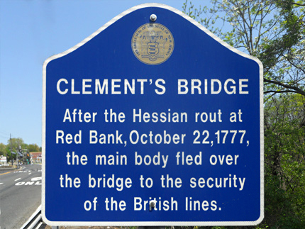
A historic sign is located at the modern bridge which stands at the site of the 1777 bridge. The sign mentions the British retreat over the bridge but not their approach which had occurred several hours earlier that day.

Old Deptford Strangers Burial Ground
Caulfield Ave. near Dexter Ave.
Map / Directions to the Old Deptford Strangers Burial Ground
Map / Directions to all Deptford Revolutionary War Sites
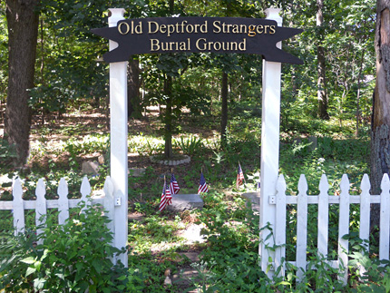
After the October 22, 1777 Battle of Red Bank, some seriously wounded Hessian soldiers were sent to Woodbury. Those that died were buried in a strangers burial ground there. That cemetery was condemned circa 1915, and the remains and stones were moved here (approximately two and half miles from the Woodbury location). [2]
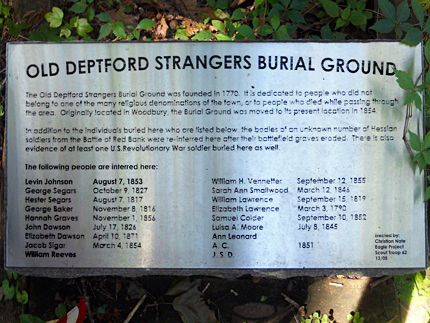
The names of the Hessian soldiers buried here are not known. A plaque at the cemetery does list the names of other people who died later that are known to be buried here. It also states that at least one American Revolutionary War soldier may also be buried here. [3]

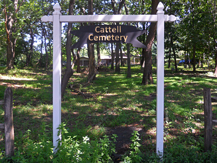
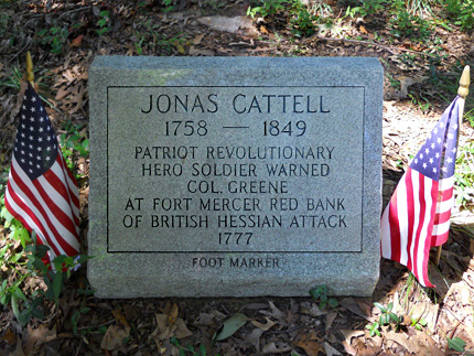
Cattell Cemetery
Evelyn Dr.
Map / Directions to Cattell Cemetery
Map / Directions to all Deptford Revolutionary War Sites
This cemetery contains the remains of members of the Cattell family, including Jonas Cattell, a hero of the Battle of Red Bank. Jonas Cattell's story is commemorated on a plaque in nearby Haddonfield, "With four cannon and 1600 Hessian troops, Count von Donop camped [in Haddonfield] en route to Fort Mercer at Red Bank. A prisoner that night, Jonas Cattell, 18 years old, was released when the enemy moved out before daylight. He ran to warn the fort ten miles distant. Col. Christopher Greene ordered that the cannon commanding the Delaware be repositioned to meet the landward attack. Thanks to the timely warning that day, Oct. 22, 1777, three hundred Colonials defeated the Hessian forces. Count von Donop was mortally wounded in the attack." [4]

1. ^ Samuel Stelle Smith, Fight for the Delaware, 1777 (Monmouth Beach, N.J.: Philip Freneau Press, 1970) pages 18-23.
This includes the map on page 20, which traces the route taken by the Hessian troops. The book states that the map was, "based largely on the extensive road research of Mr. Harry Marvin of Mullica Hill, N.J."
▸ The map is also reproduced on the "Fort Mercer is Attacked" sign at the Red Bank Historical Park.• For more information about the events mentioned in this paragraph, see the town pages linked from within the text.
2. ^ Frank H. Stewart, Notes on Old Gloucester County New Jersey - Historical Records Published by the New Jersey Historical Society of Pennsylvania Volume 1 (Camden NJ; Sinnickson Chew & Sons Company, 1917) Pages 49 and 271
Available to be read at Google Books Here3. ^ Plaque erected by Christian Nate, as part of his Eagle Scout project for Scout Troop 62, December 2005.
4. ^ Sign erected by The Francis Hopkinson Chapter, Sons of the American Revolution in 1980