
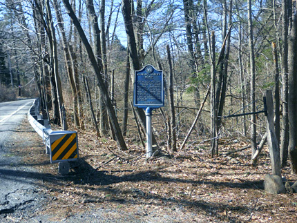
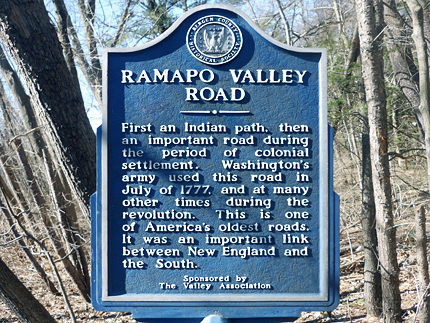
Ramapo Valley Road Historic Marker
Ramapo Valley Rd. / 3 tenths of a mile north of Cannonball Rd.
Map / Directions to Ramapo Valley Road
Map / Directions to all Mahwah Revolutionary War Sites
This historic marker describes the history of Ramapo Valley Road, "one of America's oldest roads," including its use by General George Washington's troops during the Revolutionary War. [1]
The July 1777 event referred to on the sign occurred when Washington and this troops were marching from Morristown to an area called the Clove in New York State (Now called Suffern). Washington stayed for the night at the Hendrick Van Allen house in Oakland, while his troops encamped nearby. [2]
There are additional signs and markers along Ramapo Valley Road in Mahwah related to the Revolutionary War, described in the following entries.

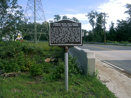
Ramapo Valley Road Bridge
Ramapo Valley Rd. at Brakeshoe Pl.
Map / Directions to Ramapo Valley Road Bridge
Map / Directions to all Mahwah Revolutionary War Sites
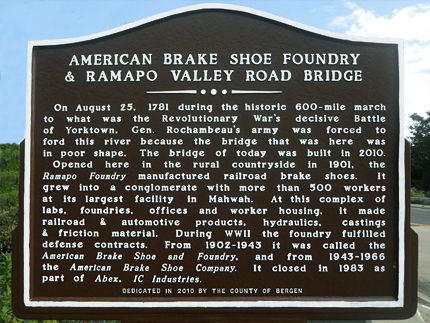
In 1781, French and American troops marched hundreds of miles to what would prove to be the final major and decisive battle of the war, the Battle of Yorktown in Yorktown, Virginia, on October 19, 1781. French troops under General Rochambeau traveled down Ramapo Valley Road on August 25, 1781 as part of this march. There was a bridge at this location over the Mahwah River, but because of its poor condition, Rochambeau's troops had to ford the river. (Fording a river refers to crossing it at a shallow point.)
This historic marker also describes the history of the American Brake Shoe and Foundry, which stood in this area in the 1900's. The bridge that currently crosses the river here was constructed in 2010. [3]
Additional markers in New Jersey related to the path to the Battle of Yorktown can be found in Liberty Corner, Pequannock, Montville, Whippany, Montgomery Township and Princeton.

Continental Soldiers Memorial Highway / W3R Markers
Ramapo Valley Rd.
Map / Directions to Ramapo Valley Road
Map / Directions to all Mahwah Revolutionary War Sites
Along Ramapo Valley Road there are additional markers to highlight its use during the Revolutionary War.
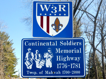
There are W3R markers, which stand for Washington-Rochambeau Revolutionary Route. As explained in the Ramapo Valley Road Bridge entry above, French troops under General Rochambeau marched down this route en route to the Battle of Yorktown.
There are also signs which commemorate Ramapo Valley Road as "Continental Soldiers Memorial Highway." There are more of these signs in neighboring Oakland. There is also a Continental Soldiers Park on Ramapo Valley Road at Ramapo Valley College.

Hopper Gristmill Site
156 Ramapo Valley Rd.
Map / Directions to the Hopper Gristmill Site
Map / Directions to all Mahwah Revolutionary War Sites
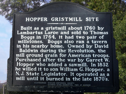
The historic sign in front of the building which houses the New York-New Jersey Trail Conference the tells the history of the Hopper Gristmill, which stood at this location from circa 1760 to the late 1870's.
A gristmill is a mill that is used to grind grain into flour. Flour from this gristmill was supplied to American troops during the Revolutionary War. [4]

1. ^ Bergen County Historical Society sign.
2. ^ For more information and accompanying source notes, see the Hendrick Van Allen House entry on Oakland page of this website.
3. ^ Historic Sign at the Ramapo Valley Bridge, dedicated in 2010 by the County of Bergen
4. ^ Historic Sign at the Hopper Gristmill site, co-sponsored by the Mahwah Historical Society, and the Historic Sites Committee, Township of Mahwah