
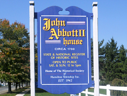
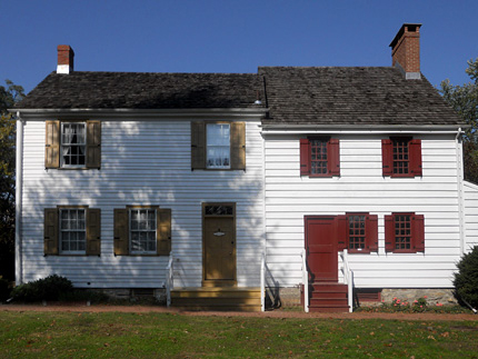
John Abbott II House
2200 Kuser Rd.
Map / Directions to the John Abbot II House
Map / Directions to all Hamilton Revolutionary War Sites
(609) 585-1686
The John Abbott II House was built circa 1730. The following account of the house's role in the Revolutionary War is from Helen Almy West's History of Hamilton Township, written in 1954:
"It was in the latter part of the year 1776, and the British were advancing upon Trenton. Samuel Tucker, the State Treasurer, hearing of the British advance, wanted to save the State's money and his own. On November 30, 1776 he took his personal effects and those of the estates of which he was executor, along with the unsigned public money, to the home of John Abbot. The British arrived in Trenton on December 8, 1776, and on that day Mr. Tucker took the signed public money, amounting to more than fifteen hundred pounds, and a thousand pounds he held in trust, and secreted it with other moneys in the Abbott home.
"The British were told of the hiding place by a Mrs. Mary Pointing, of Trenton, and she led a detachment of British troops, about five hundred strong, to the house of John Abbott. They raided the house and captured Tucker's black trunk, containing deeds, etc. and the unsigned paper money.
"When the British arrived at the house, the family pretended they were getting ready to move, and they had placed the money in the bottom of tubs, and over it placed dishes and broken household utensils of various kinds and carried them to the cellar. The soldiers ransacked the house from top to bottom, found the tubs, but were heard to mutter that they contained nothing but 'old trumpery' and did not search them. The soldiers took Tucker's trunk with his papers and the unsigned 'shin plasters' but did not get the money.
"Several days after this raid Samuel Tucker was returning to his family in Trenton when, near White Horse, he was met by twenty mounted Tories. Their leader, John Leonard, pointed a pistol at Tucker's breast and told him he had orders from the British to take him prisoner. Robert Pearson, twin brother of Isaac Pearson [see Issac Pearson House entry below], appeared at the scene and gave his parole that Tucker should stay with him until he was wanted by the British." [1]

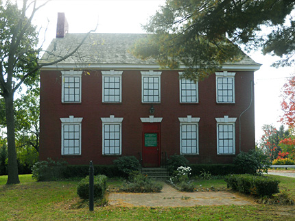
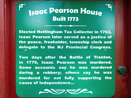
Isaac Pearson House
Hobson Ave. and Emeline Ave.
Map / Directions to the Isaac Pearson House
Map / Directions to all Hamilton Revolutionary War Sites
Isaac Pearson was born August 3, 1739. The Pearsons were a prominent local family. His grandfather Robert Pearson was one of the area's first settlers, emigrating from England in 1678. This house was built by Isaac Pearson in 1773.[2]
At the beginning of the Revolutionary War, Isaac Pearson was a politically-active supporter of the cause of Independence. In 1775-1776 he served in the New Jersey Provincial Congress as a delegate from Burlington County. [3] (At that time this area was part of Burlington County. Mercer County was formed decades later in 1838. It was named for Revolutionary War General Hugh Mercer, who died from wounds suffered at the Battle of Princeton.) [4]
In late 1776, the American army suffered a series of defeats in New York, and began a retreat across New Jersey. British forces invaded the state, and offered local residents amnesty if they took an oath of allegiance to Britain. Those who did not take the oath were targeted by the British. It is believed under these circumstance Isaac Pearson decided to take the oath of allegiance, and headed on his horse to British-occupied New Brunswick to do so. Along the way, he was murdered. Accounts differ as to whether he was killed because of his wavering commitment to the cause of Independence, or as part of a robbery. [5]
According to the Hamilton Township website:
"Hamilton Township recently took possession of the home and is now in the process of
restoring the site and converting it for use as a tourist attraction."

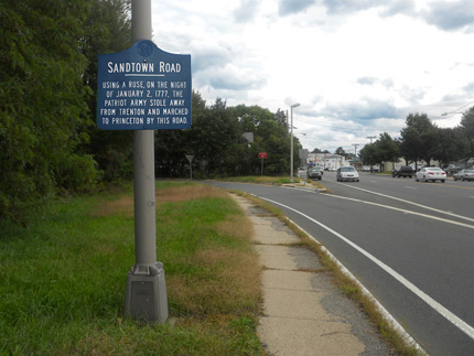
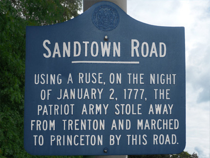
Sandtown Road Marker
Nottingham Way (Rt. 33) near the off ramp from Rt. 295
Map / Directions to the Sandtown Road Marker
Map / Directions to all Hamilton Revolutionary War Sites
This historic sign notes that this road was once known as Sandtown Road, part of the route taken by Washington's army on the evening of January 2, 1777, following the Second Battle of Trenton to the Battle of Princeton. [6] In addition to this sign, there is a series of twelve obelisks that follow their full route.

1. ^ Helen Almy West, A History of Hamilton Township, Mercer County, New Jersey (Trenton: Trenton Printing Company, 1954) Pages18-19
2. ^ Helen Almy West, A History of Hamilton Township, Mercer County, New Jersey (Trenton: Trenton Printing Company, 1954) Pages 11-17
3. ^ Minutes of the Provincial Congress and the Council of Safety of the State of New Jersey (Trenton: Naar, Day & Naar, 1879) Pages 169-170, 183-184, 197, and 325
Available to be read at the Internet Archive here4. ^ Mercer County was formed from in 1838 from portions of Hunterdon, Burlington, Middlesex and Somerset Counties.
For details see:
John F. Snyder, The Story of New Jersey's Civil Boundaries: 1606-1968 (Trenton: Bureau of Geology and Topography, 1969) Page 161
Available as a PDF on the State of New Jersey website here. (Note that although the information is on page numbered 161 of the document, it is on pages 157 of the PDF file.)5. ^ Helen Almy West, A History of Hamilton Township, Mercer County, New Jersey (Trenton: Trenton Printing Company, 1954) Pages 16-17
6. ^ State of New Jersey historic sign