

Schraalenburgh Road
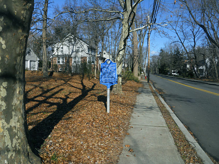
Marker is at the corner of Schraalenburgh Rd. and Massachusetts Ave, near the Dumont line
Map / Directions to the Schraalenburgh Road Historic Marker
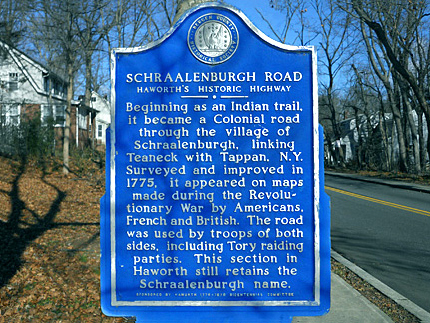
A marker at this corner explains the history of Schraalenburgh Road, including its Revolutionary War significance: [1]
• It was surveyed and improved in 1775, the year the war began at the Battles of Lexington and Concord in Massachusetts.
• A great deal of activity and movements of troops and raiding parties occurred in Bergen County, and Schraalenburgh Road was used often by both troops on both sides of the conflict
• Maps created by American, British and French during the war show the road.
• Residents of Bergen County were regularly the victims of raids by British troops, as well as parties of Tories. (Tories were Americans who remained loyal to the British in the Revolutionary War.) Schraalenburgh Road was used by some of these raiding parties.
For more information about specific instances of damage, theft and capture during raids in Bergen County, see the Cresskill, Demarest, Dumont, Elmwood Park, Hackensack, Harrington Park, and Ridgefield Park pages of this website.

1. ^ Bergen County Historical Society historic marker
• For more information and accompanying source notes about the raids mentioned, see the Cresskill, Demarest, Dumont, Elmwood Park, Hackensack, Harrington Park, and Ridgefield Park pages of this website.